Virtual Journey: Lost Coast, CA, USA on Highway 211 - From Victorian Ferndale to The Beach, the Mountains of Mateel to the Avenue of the Giants. Humboldt County.

It's an Excellent Part of Planet Earth. Start a Few Miles South of Eureka on Highway 101. 

MAP: https://goo.gl/maps/JUXBSKjDWsqoiqYTA

The Bridge at Fernbridge - Humboldt County California
The Bridge at Fernbridge
Humboldt County, California


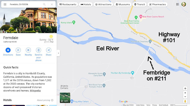
MAP of Humboldt County CA Fernbridge Highway 101 & 211
MAP of Humboldt County, CA 
Fernbridge at Highway 101 & 211

From Eureka, Drive South on 101 to the Fernbridge Ferndale Exit #692... 

Highway 101 Ferndale Fernbridge Exit #692

Take a Right at the End of the Off Ramp and Drive to the Humboldt Creamery. Take a Right onto #211 and Drive Over the Bridge. 

Driving over the Bridge at Fernbridge, CA - Humboldt Creamery on the Right
Driving over the Bridge at Fernbridge, CA -
Humboldt Creamery on the Right

Not much water in the EEL River. 
Drought and the Banks have turned Green... 
Looking Upstream EEL River - On the Bridge at Fernbridge
Looking Upstream EEL River -
On the Bridge at Fernbridge

Looking Downstream EEL River - On the Bridge at Fernbridge
Looking Downstream EEL River -
On the Bridge at Fernbridge


Looking Straight Ahead on the Bridge at Fernbridge CA 211
Looking Straight Ahead
on the Bridge at Fernbridge - CA 211

Dairy Farms On the Road to Ferndale CA 211 EEl River Valley
Dairy Farms On the Road to Ferndale.
CA 211 in the EEl River Valley
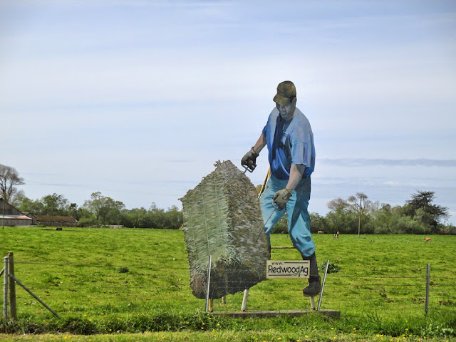
Sign near Ferndale for the Redwood Ag Club
Closeup of the Sign for the Redwood Ag Club
Another Sign near Ferndale for the Redwood Ag Club
Another Sign for the Redwood Ag Club


Cows in the EEL River Valley - Bear River Casino on the Hill
Cows in the EEL River Valley.
Bear River Casino on the Hill

Entering Ferndale:
Ferndale Community Church
Pink Dollhouse on the Main Street of Ferndale


The Main Street of Ferndale, CA
The Main Street of Ferndale

People Keep on Posting that there were no White People in The Bible... FALSE... Romans were White... and They were a BIG Part of the Bible Story... The Father of Jesus was a Roman who "had his way" with Mary... and Joseph ended up Raising another man's Son...

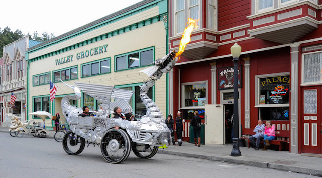
Duane Flatmo's Dragon in Ferndale.
Duane Flatmo's Fire Breathing Dragon
Kinetic Sculpture

Kinetic Sculpture Race in Arcata, California 2014 - gvan42
Duane Flatmo, The Artist, 
Changing Tires on the Dragon

The Victorian Inn in Ferndale - Turn Right Here
The Victorian Inn in Ferndale
 Turn Right Here onto Ocean Avenue
In Order to Travel to The Lost Coast.

The Bar inside the Victorian Inn Ferndale, CA
The Bar Inside the Victorian Inn
Note the Scale Model of the Sailing Ship!


A Right turn onto Ocean Ave in Ferndale
Make a Right Turn onto Ocean Avenue.

Left Turn off of Ocean onto Wildcat Road - Capetown Petrolia
Make a Left Turn off of Ocean Ave. onto
Wildcat Ave and Mattole Road
 to Capetown Petrolia

~~~~~~ (~);-} ~~~~~~

If You Simply Continue on Ocean Ave 
You Will Visit The Centerville Beach Park.
an Excellent Adventure Itself!
Centerville Beach Park in Humboldt County, CA

~~~~~~ (~);-} ~~~~~~

Continuing On Highway #211 towards 
Capetown and Petrolia


Wildcat Ave Ferndale, CA

Going Up Wildcat Ave... 
It Looks Like This for Miles!

On the Right, Just Past Camelot Lane
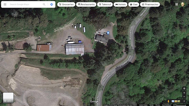
is the Copper Doctor Factory.
They Make Copper Chain Bracelets 
FOR HEALTH!
Satellite View of the Copper Doctor Factory
They've Been Selling Bracelets for 20 Years... 

The Road to Sleepy Hollow - Humboldt County
The Road to "Sleepy Hollow"
A Locked Gate and a Long Road to
a Marijuana Farm? Who Knows!

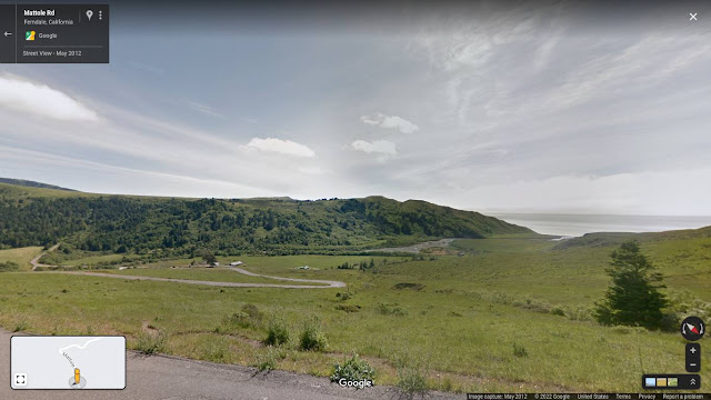
another View of the Pacific Ocean at Capetown in Humboldt County
A View of the Pacific Ocean
at Capetown. Look! There's the Road
We Will be Driving On In a Minute!
Down There Next to That Farm.

a pig in the Middle of the Road in Capetown, CA - Humboldt County
Watch Out!
There's a pig in the Middle of the Road
a pig in the Middle of the Road

and then a Mile on down the Road 
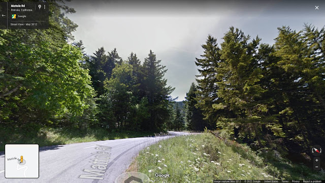
We Encounter the Dark Redwood Forest.

When driving from a Sunny Meadow 
to the Dark Forest, a Person's Eyes 
Take a Moment to Get Used to 
the Low Light Conditions... 
Basically, You are Driving BLIND... 
Just Keep on Going Straight and Don't Brake!

Pacific Ocean - Sugarloaf Island, Humboldt County, CA
Pacific Ocean - Sugarloaf Island

Inviting Pullout asking Me to Stop, Park and Enjoy the View of the Black Sand Beach - Mattole Road
Inviting Pullout asking Me to Stop, Park
and Enjoy the View of the Black Sand Beach.
That is NOT a Boat in the Water. It's a Rock. 


More Big Black Rocks in the Pacific Ocean. Humboldt County, CA
More Big Black Rocks in the Pacific Ocean. 
It's Like this For a Mile... or Maybe Five!

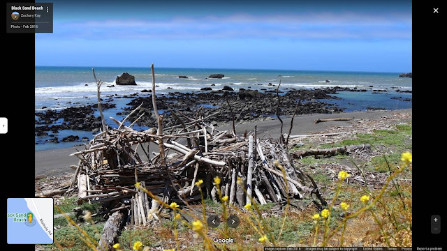
Driftwood House on Lost Coast in Humboldt County CA.j
Driftwood House on Lost Coast

Driftwood House at the Beach
Viewed from the Beach Side

Black Sand Beach - Lost Coast - Humboldt County CA.
Black Sand Beach


Lost Coast - Devils Gate - Humboldt County CA
Devils Gate

Cows on the Beach. Humboldt County, CA
Cows at the Beach. 
The Rancher Saves Money by Not 
Having to Fence the Ocean Side... 

leaving the Beach and Going Up into The Mountains.
Leaving the Beach and 
Going Up into The Mountains.

Eucalyptus Trees in the Pasture

Now Entering Petrolia:

Map of Petrolia, CA - Humboldt County

Petrolia General Store and Fire Station

Mattole Community Center - Petrolia, CA
Mattole Valley Community Center

Founded in 1975, the Mattole Valley Community Center (MVCC) has occupied this renovated old schoolhouse since 1978. The MVCC is home to many activities. 

Inside the Mattole Valley Community Center - Concert
Inside - Concert

The local preschool started here. In the aftermath of the major 1992 earthquakes, the building served as the emergency response center for the Red Cross, FEMA, and the Office of Emergency Services. The main offices of the Mattole Restoration Council are housed upstairs.
Cabaret evenings of local musical and acting talent raise money for local non-profits and are a vibrant MVCC tradition. Community organizations regularly meet here. Important recent meetings addressed the Marine Life Protected Area designation, fire-safe planning and a proposed wind energy project.
The Sunday Farmers’ Market (11am-1pm) and Sunday café currently are a popular weekly gathering spot for community members. Classes and practices include yoga, dance, Zumba, qi-gong, and aikido. Fund-raising festivals and private parties are held both inside and out. Young children enjoy the playground.
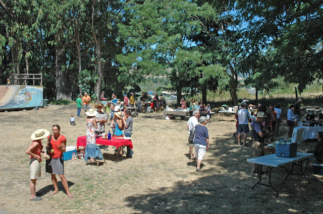
Farmers Market at Mattole Valley Community Center - Petrolia, CA
Farmer's Market
http://www.mattolevalleycc.com/

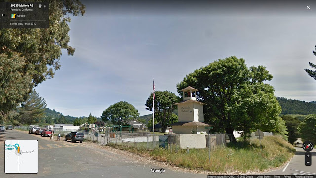
Mattole School Petrolia CA
Mattole School

Bridge over Mattole River

Looking Downstream at the Mattole River

Looking Upstream at the Mattole River

Driving Parallel to the Mattole River

Going Up into the Mountains - Mateel
Going Up into the Mountains of the Mateel.
The Remote Wooded Area Between
The Mattole River and The EEL River.

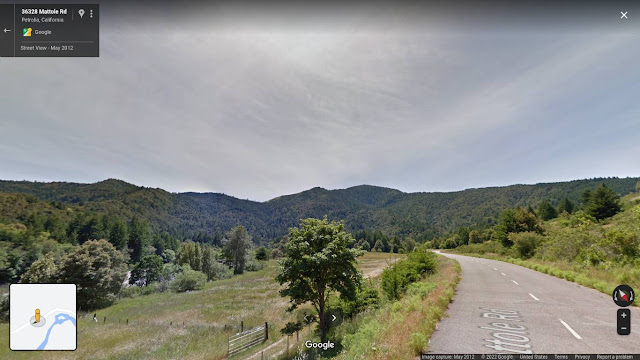
Meadow and Woods on Mattole Road Humboldt County CA.jpg
Meadow and Woods on the Mattole Road

Dark Woods on the Road - Mateel Area of Humboldt County
Another Shadow of the Dark Woods.


Farmland near Petrolia CA
Six Farms on this Dirt Road

Rangers Home at the A W Way County Park, Humboldt County CA
Rangers Home at the Arthur W. Way County Park

Road Leading to the Mattole Presbyterian Campground.
and Right on the River is a Presbyterian Campground 


Mattole Camp and Retreat Center - Swimming in the River
Mattole Campground and Retreat Center
Swimming in the River

Deer in the Woods of Remote Humboldt County CA
Sharing the Road with Residents

and we are about HALFWAY From Ferndale to the Avenue of the Giants!

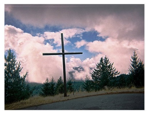
Cross Made out of Two Telephone Poles - Honeydew
Cross Made Out of Two Telephone Poles 
at the Mount Saint Mercy Sobriety Retreat.
Somewhere between Petrolia and Honeydew... 
When I took this Picture the Wind 
was Blowing the Clouds Around... 
It was Quite Exciting to be 
on the Top of the World...  

View from the Mountain Top of the Mateel Area of Humboldt County CA.
On a Clear Day Looking at The Mateel...

Mattole River near Honeydew CA
Mattole River as Viewed from Up High

Honeydew General Store - in Humboldt County, CA
Honeydew General Store

and that's the End of the Google Street View
of Highway 211 to The Avenue of the Giants.


They Took The Wilder Ridge Road Until they Got to The Beaver Ridge Big Rig Shortcut, Then They Gave UP and Stopped Filming!
The Beaver Ridge Big Rig Shortcut. Humboldt County, CA
A Dirt Road Sharp Turn was the End of the Line for Google Maps Street View... Note the Dust!
 

Map of Honeydew, CA
Like the Old Sailors Maps, "Here be Monsters"
 The Uncharted Road in Rural Humboldt County. 

Honeydew Day Use Area - Creek and Deer


Marijuana Farm Busted near Honeydew, CA

Satellite Image of Honeydew and the Mattole Road to the Avenue of the Giants
Satellite Image of Honeydew and
the Mattole Road to the Avenue of the Giants

Bull Creek Cemetery Woods near Honeydew CA
Bull Creek Cemetery Woods near Honeydew, CA

Blue Slide Day Use Area near Honeydew CA
Blue Slide Day Use Area

Big Trees Day Use Area near Honeydew CA
Big Trees Day Use Area near Honeydew, CA

Rockefeller Loop Trail near the Avenue of the Giants CA.
Rockefeller Loop Trail
near the Avenue of the Giants

Looking Up at the Redwood Trees in the Avenue of the Giants CA
Looking Up at the Redwood Trees


Roads (From Left to Right) The Avenue of the Giants, Highway 101, Road to Honeydew, Petrolia, the Lost Coast and Ferndale. 
Highway 101 Bridge over EEL River

Intersection of 211 and the Avenue of the Giants
Intersection of 211 and the Avenue of the Giants.
Underneath The Freeway 101

EEL River as Seen from the Avenue of the Giants
EEL River as Seen from the Avenue of the Giants.
Sandbar on the Left is Overflow Parking for
the Marathon Race. This Location is Both the Beginning and the End. 


Map: Highway 211 meets the Avenue of the Giants
Map: Highway 211 Meets the Avenue of the Giants
https://goo.gl/maps/NKpnAZejUqWisMK37


Justin and Gregory Vanderlaan on the Avenue of the Giants
Justin and Gregory Vanderlaan
on the Avenue of the Giants

Great Book: "Beyond Counterculture" - The History of the Mateel Section of Humboldt County, California... 

Settled by Hippies Fleeing The Haight Ashbury section of San Francisco in the Late Sixties in order to Farm Cannabis 


Beyond Counterculture is the History of the Hippies who fled The Haight Ashbury District of San Francisco and Moved to Southern Humboldt County to Earn their living farming Cannabis. Originally a Doctoral thesis.

Between the Eel and Matole Rivers, Garberville and the Lost Coast.
Mateel is a Sunny and Warm.
Once PALCO logged the area, the land was really cheap. Perfect for growing Marijuana Outdoors. This location is Not on Google Streetview.

Beyond Counterculture: The Community of Mateel 

Paperback – June, 1990 by Jentri Anders.


another way to get there... 
Map of Humboldt County - Visiting Mateel
Travel North From San Francisco over the Golden Gate Bridge on Highway 101... Using Exit 663, Turn Onto the Avenue of the Giants at Dyerville. Take a Left Going Towards Honeydew (you drive under Highway 101). Follow the Lower Bull Creek Flats Road to the Mattole Road. Follow it on to Honeydew, Petrolia, The Lost Coast, Ferndale and then Fernbridge... 

more to come later... I'm taking a break... 

~~~~~~ (~);-} ~~~~~~

Other Journeys

~~~~~~ (~);-} ~~~~~~

Virtual Journey: Canada Tourist Guide & Autobiography. We Went on our Honeymoon to Vancouver, BC. We Rode a Bicycle built for Two in Stanley Park... and Many More Wonderful Places to Visit.


Virtual Journey: Eureka, Arcata, Trinidad - Visit Northern California's Coast. We Have Our Own Little World Here Behind The Redwood Curtain! https://gvan42.blogspot.com/2022/05/eureka-arcata-trinidad.html


Virtual Journey: Trinity Alps, CA, USA - Drive the Bigfoot Highway (299) From Arcata on the Coast to Redding in the Central Valley. White Water Rafting! Gold Rush Ghost Towns!


Virtual Journey: to the Star Wars Flying Motorcycles Redwood Forest on Hwy 36 in Remote Humboldt County, CA, USA - and the Bridgeville UFO Festival, The Town of Mad River. 

https://gvan42.blogspot.com/2022/03/virtual-journey-hwy-36-remote-humboldt.html


Virtual Journey: Lost Coast, CA, USA on Highway 211 - From Victorian Ferndale to The Beach, the Mountains of Mateel to the Avenue of the Giants. Humboldt County. 

https://gvan42.blogspot.com/2022/03/a-virtual-drive-thru-remote-humboldt.html


Virtual Journey to San Francisco - Boat Ride on the Red and White Fleet. Under the Golden Gate Bridge and Around Alcatraz Island... and MORE!


Virtual Journey: The Smithsonian and Washington DC. Instead of Buying Gasoline and Driving There, Take this Magic Trip Instead! A Guided Tour to the Places My Family Wanted to See... 


My Father liked to Travel with the people from the Willow Glen Senior Center. They had a Sign up sheet for a Bus Ride to Bear River Casino near Eureka. He'd Call me and I'd meet him there and we'd go drive around Humboldt County... Doing Tourist Fun Stuff... Then they Toured the Loleta Cheese Factory and Watched the Christmas Truck Parade... He did a Lot of traveling with the UC Berkeley Alumni Club. That would be a dozen tourists and a Tour Guide that Spoke the Language and Knew the History of the Place... He went to Odessa, Ukraine and Copper Canyon Mexico... Really handy having a Guide that made everything work smoothly...

~~~~~~ (~);-} ~~~~~~

A man I knew had plastic surgery on his stomach to make it smaller... so he would lose weight... because he thought he was too fat... now he looks terrible... as if he's starving... unhealthy... thin... Wasting Away...

FOLKS: Be Happy Being Fat! or Be Happy Being Thin! Unless you are extremely fat or Extremely Thin... Then go see a Real Doctor for some Valid Advice... DO NOT Go to a Plastic Surgeon first. Their recommendation will always be "buy surgery from me!" The Man I know Lives and Works in Hollywood... and the Brainwashing has Totally Fried His Understanding of Reality...

My feeling about being "overweight" is: My Ancestors Lived in Holland and Scotland. Starving to Death in the Winter was a Major Problem. Therefore, We carried a Layer of FAT on Our Bodies to use During Those Months When Food Was Scarce... We The Fat People Survived, and Had Children... Passing on the "Fat Gene" to My Great Grandparents... What Right Have "Others" to tell me what weight I should Be? PFBBBT!


~~~~~~ (~);-} ~~~~~~

If you ever feel like Boycotting Koch Industries, Here's a List!
  • Paper Products: 
  • Angelsoft, Brawny, Dixie, Mardi Gras, Quilted Northern, Soft n Gentle, Sparkle, Vanity Fair
  • Wood: Georgia-Pacific (largest plywood manufacturer in US – also owns most of the paper companies above).
  • Textiles & Plastics: Polarguard, Stainmaster, Dacron, Lycra, CoolMax/SolarMax, Thermolite, and more.
  • Chemicals, Coal, & Oil: Crude oil processing, Flint Hills Resources, lots of other commodities handled.
  • Nitrogen: One more reason to make your own fertilizer – Koch Industries produces many synthetic fertilizers.
~~~~~~(~);-} ~~~~~~

We at the Folsom Senior Center have a Group Sing Along Club That Not only Performs for Old People... We ARE Old People... 20 Singers and One Electric Piano. and Three Ring Binders with all the words to all those "Old Timey" Songs... I believe That we are Doing our Part to Prevent Mental Health Decay... In Folsom, CA near Sacramento.
On Mondays: 9:30–11 a.m. The Off-Key Singers; a fun and social group! 

Chichen Itza with a Lot Of People

I Wonder What Event Drew Such a Large Crowd To Chichen Itza on the Yucatan Peninsula in Mexico. 12/29/2019... Just another Christmas Tourist Season...


Popular Posts