Showing posts with label photo. Show all posts

Housing Subdivisions With a Waterway to Dock Your Boat in Back and a Motorway to Park Your Car In Front. Satellite Pictures... King Salmon, Venice, Marina Del Ray, Discovery Bay, Tahoe Keys and Delta Cove


King Salmon Map
Map of King Salmon...
Just South of Eureka, California
Link:
  https://goo.gl/maps/nx5HS2NJvkzmcd749

King Salmon, CA Closeup Satellite View


King Salmon Satellite View Including Gills Restaurant and PGE
King Salmon Satellite View
Including Gills Restaurant and PG&E
and That Very Gentle Beach for Wading.

Venice California - canals satellite view
Venice California - canals - satellite view
https://goo.gl/maps/fSbZNqaxZ4oBP4RB9

Marina Del Rey Apartments With Boat Docks near Venice
Marina Del Rey Apartments
With Boat Docks near Venice
https://goo.gl/maps/P5xvX49qKtTzaoK79


Discovery Bay in the Sacramento River Delta Area Satellite View
Discovery Bay in the Sacramento River Delta Area

Delta Coves Subdivision Planned Boat Community in the Sacramento River Delta Area
Delta Coves Subdivision Planned Boat Community
NO HOUSES YET!
in the Sacramento River Delta Area


and... Tahoe Keys - South Shore Lake Tahoe... 

Tahoe Keys Map

tahoe keys sat image.jpg


There is growing concern about the spread of aquatic invasive and nuisance plant species which cover over 90 percent of the Tahoe Keys lagoons. Despite the considerable management and financial investment of the Tahoe Keys Property Owners Association (TKPOA) to control this problem, weeds continue to spread and management costs continue to mount.


Virtual Journeys: Travel Without Leaving Home

Virtual Avenue of the Giants Tour. “Drive” thru the Giant Redwood Trees… Beautiful Humboldt County, California, USA

LINK: https://gvan42.blogspot.com/2024/01/virtual-avenue-of-giants-humboldt-co.html
Ave of the Giants Virtual Journey

Photographs of a Journey to the Headwaters Forest – Now a State Reserve… Near Eureka, CA – Plus The Story of How It Came To Be!

LINK: https://gvan42.blogspot.com/2018/04/two-pinecones-in-humid-weather-and.html

Rainbow Gathering July 1-7, 2024 Will Be In CALIFORNIA… Exact Location To Be Revealed June 15th… and As Soon as I Know, I’ll Post Driving Directions and Maps Here…

LINK: https://gvan42.blogspot.com/2022/12/rainbow-gathering-2023.html

Duane Flatmo Murals in Eureka, California – As they were being Painted – and the Kinetic Sculpture Race – An Art Tourists Delight!

LINK: https://gvan42.blogspot.com/2021/06/duane-flatmo-murals-in-eureka.html

JET SETTERS: When Will They Ever Learn? Causing Air Pollution and Climate Change is No Longer “Totally Groovy”

LINK: https://gvan42.blogspot.com/2020/06/do-not-fly-on-jet-airplanes-you-all.html

Carson Mansion – Zipper Carnival Ride – Fireworks – Eureka California – Kinetic Sculpture Race – Photographs from California’s Rugged North Coast

LINK: https://gvan42.blogspot.com/2018/10/carson-mansion-zipper-carnival-ride.html

Travel Causes Climate Change – JUST DON’T GO! Burning Gasoline in Cars to Go to Grandma’s House? That’s CRAZY!

LINK: https://gvan42.blogspot.com/2022/11/stop-climate-change.html

Virtual Journey: Eureka, Arcata, Trinidad – Visit Northern California’s Coast. We Have Our Own Little World Here Behind The Redwood Curtain!

LINK: https://gvan42.blogspot.com/2022/05/eureka-arcata-trinidad.html

Virtual Journey: New York: Excellent Places to Go! Autobiography…

LINK: https://gvan42.blogspot.com/2022/06/virtual-journey-new-york.html

Virtual Journey: Canada Tourist Guide & Autobiography. Excellent Places to Visit…

LINK: https://gvan42.blogspot.com/2022/05/canada-tourist-guide.html

Virtual Journey: Trinity Alps, CA, USA – Simulates a Drive on the Bigfoot Highway (299) From Arcata on the Coast to Redding in the Central Valley. White Water Rafting! Gold Rush Ghost Towns!

LINK: https://gvan42.blogspot.com/2022/04/highway-299-virtual-journey.html

Virtual Journey: to the Star Wars Flying Motorcycles Redwood Forest on Hwy 36 in Remote Humboldt County, CA, USA – and the Bridgeville UFO Festival, The Town of Mad River.

LINK: https://gvan42.blogspot.com/2022/03/virtual-journey-hwy-36-remote-humboldt.html

Virtual Journey: Lost Coast, CA, USA on Highway 211 – From Victorian Ferndale to The Beach, the Mountains of Mateel to the Avenue of the Giants. Humboldt County.

LINK: https://gvan42.blogspot.com/2022/03/a-virtual-drive-thru-remote-humboldt.html

Virtual Journey to San Francisco – Boat Ride on the Red and White Fleet. Under the Golden Gate Bridge and Around Alcatraz Island… and MORE!

LINK: https://gvan42.blogspot.com/2022/04/journey-to-san-francisco.html
Train Trail from San Francisco to Humboldt Bay


More than a century ago, a railroad was constructed to shuttle passengers and redwood logs between San Francisco and Humboldt Bay.

Now the since-abandoned train track could be transformed into a 307-mile pathway through remote, wild country along California’s North Coast, a move advocates hope will create a world-class outdoors destination and jump-start the economy.

The Great Redwood Trail moved closer to realization this week with the release of a document mapping out the planning, construction and management of the trail in Mendocino, Trinity and Humboldt counties, or the northern portion of the envisioned path. Segments in Sonoma and Marin counties will be planned separately.
“I would put it in the category of the Pacific Crest Trail, the Appalachian Trail — these large, landscape-scale trails that provide an experience for people to see areas that they just would never have access to otherwise,” said Caryl Hart, chair of the California Coastal Commission and board member of the Great Redwood Trail Agency, which is tasked with developing the path.

If realized, the project would be the longest so-called rail trail in the country, generally following the defunct track through towering redwoods and along rushing rivers teeming with salmon. The relatively flat trail would accommodate hikers, bikers and horseback riders while potentially providing an economic infusion to small towns struggling amid the decline of logging and rise of legal cannabis.

Officials say it’s probably 20 years away from completion but will move forward section by section.

September 11th Mysteries - What Computer Systems "Conveniently" Vanished During All The Fires... Many Financial Records at the Pentagon & Wall Street!

 “On September 10, 2001, former Secretary of Defense Donald Rumsfeld said, “Our financial systems are decades old. According to some estimates, we cannot track $2.3 trillion in transactions. We cannot share information from floor to floor in this building because it’s stored on dozens of technological systems that are inaccessible or incompatible,” the Sanders-Grassley Audit the Pentagon Act states. A day after Rumsfeld’s announcement, the building was targeted in the 9/11 attack where the alleged accounting effort was taking place. The $2.3 trillion remains unaccounted for to this day.

No Photograph of an Airplane at the Pentagon on 9/11/2001


Letter

The WTC7 collapse, shown above, was the only building not hit by a plane. The government simply said a fire managed to melt steel beams and destroy the building. The demolished area was the precise location of the Pentagon audit, and also happened to be the location of my computer system. Here is the letter I received from the SEC explaining that everything had simply been destroyed on 9/11. That was the final answer and no questions were permitted. The government managed to evacuate all the government employees prior to the attack; the civilians in other towers were not so lucky.

The Pentagon must be held accountable. I comment Bernie Sanders for remaining consistent over his career, even if I disagree with him on most issues. Sanders and Senator Grassley have been asking the government to determine why trillions in taxpayer funding continually disappears. The Pentagon controls nearly 70% of the budget of the Federal government. And yet, when they make announcements like the $600 billion in aid missing to Ukraine, no one bats an eye. The Deep State funnels money through the Pentagon without issue. Congress ordered the Pentagon to pass an audit, and yet it remains the only government agency that has failed to do so.

We the people deserve to know where TRILLIONS in funding have gone. Clearly, this is deeper than an accounting error. The missing $2.3 trillion was first noticed in 1999, during Clinton’s presidency and not that of Bush. Is any government agency for the people? The FBI, CIA, FDA, DoD, SEC, and every three-letter agency seem to be the guard dogs of the Deep State. Rumsfeld had this to say about the Pentagon:“It governs by dictating five-year plans. From a single capital, it attempts to impose its demands across time zones, continents, oceans and beyond. With brutal consistency, it stifles free thought and crushes new ideas. It disrupts the defense of the United States and places the lives of men and women in uniform at risk. Perhaps this adversary sounds like the former Soviet Union, but that enemy is gone: our foes are more subtle and implacable today. You may think I’m describing one of the last decrepit dictators of the world. But their day, too, is almost past, and they cannot match the strength and size of this adversary. The adversary’s closer to home. It’s the Pentagon bureaucracy.”

Photoshop Tutorial: "Highlights & Shadows" Can Save a Picture Where You Can't See Important Parts. FREE from Pixlr online Photo Editor.


Highlights & Shadows photo filter can save a picture where an inportant part can't be seen - pixler.com FREE online photo studio - gvan42
Highlights & Shadows at Work. 
pixler.com FREE online photo studio 
You Can Make Dark Areas Lighter
and Light Areas Darker 
AT THE SAME TIME.

How to Use the Highlights & Shadows Filter in pixlr.com
It's Located in Adjustments
With Two Back and Forth Sliders

I Modified a Series of Pictures... In the Originals, You couldn't see the Murals Because of the Shadows. They are Painted Underneath the Highway 99 Overpass in Chico, Ca. by Gregg Payne.

Example of a Photo Retouched using the pixlr Highlights & Shadows Filter

https://gvan42.blogspot.com/2017/06/mural-in-chico-by-gregg-payne-birds.html

an alert reader asked if I was trying to learn how to use Photoshop?

Well, I don't Own Photoshop and I will Not be buying it in the Future. Victoria bought me an Official Disc about 15 Years ago... and I loved it... Then I bought a Windows 10 Laptop and The Disc I Owned WOULD NOT WORK on the New Operating System... Yes, Adobe Still works on The Computer at Home in Eureka but I Live in Orangevale and I use a Laptop... Adobe & Microsoft Teamed Up to FORCE People to Buy New, New, New Stuff... That Does Exactly What the Old Stuff Did Already!

SO... Now I Bought a Google Chromebook that does not use any type of Windows Operating System... and I Use Pixlr.com to do Potatoshopping!

~~~~~~ (~);-} ~~~~~~

Potatoshop Tutorial: How to Improve Portraits of your Friends... Resample image Height=106% Width=94%. Suddenly, Everyone got Taller and Thinner! It's a Magic Trick. Do not tell your friends THAT it was done. In order for this to really work, they must Remain Unaware. They Just Think, Hey I look good! Works in every photo image processing program. Try blurring the cheeks and forehead on your friend's faces.  Instantly Younger... Removes Wrinkles...


~~~~~~ (~);-} ~~~~~~
I Make sure I post my words and Pictures on Parler, Gab, Ello, Mastadon, Minds, Twitter, Devient Art, LinkedIn, MeWe, Tribel, Tumblr, Flipboard, 4Chan, Reddit, Medium, Occupy and Viadeo... and then FaceBORG's Opinions are Not That Important... 

~~~~~~ (~);-} ~~~~~~

My Own Personal Boycott: I'm on strike against Amazon... I canceled my Amazon Prime Monthly Bill (what a Rip-Off) and Haven't purchased anything in 2 Months... Usually I buy something about Twice a month... Food, Clothes, WhatEVER... A Guitar... 2 Honer Harmonicas... a Spyglass... Shoes... a Gym Bag... I've Been shopping there for YEARS... But JEFF BEZOS Has Been Behaving Badly Recently so... I'm Buying Nothing... The Old Folks Home I Live at Shops at Costco and I Can Survive on What they Feed Me...

The Purchase of the Spyglass still troubles me... I wanted a Telescope to Look at the Boats going in and Out of Humboldt Bay... I Had NO IDEA about which product i wanted to buy... So I went to a Local Sporting Goods Store (Bucksport) and asked the Clerk many questions and looked thru many telescopes and figured out which one was best for me... Then I said Thanks, went home and Bought it on Amazon... The Local store Paid that Clerks Paycheck, and the rent, heat and light on the Building but... I Spent Nothing at Bucksport in Eureka.

Mural by Flatmo on Bucksport Store in Eureka, CA

on a Totally Different Subject:

I'm suspicious about ALL "Think Tanks" - Pew, Heritage - RAND... I believe They Choose the Answer they Want to Promote FIRST... and Then Find "Facts" That Verify That Answer... The Exact OPPOSITE of the Scientific Method... Where You Collect Facts First and then Come to a Conclusion after Studying those Facts... Especially corrupt is the George Mason University... Their Entire Shtick is Telling Congressmen and Senators What to Think & How to Vote. Funded by the Koch Brothers https://en.wikipedia.org/wiki/Democracy_in_Chains

Dillon Beach Resort, CA

 
SE is At Dillon Beach, CA (a Bit North of Pt Reyes)

and She Said:
Northern California: where we don't let a silly thing like cold weather interfere with our time at the beach. We always come prepared for anything. Chilly? Throw on a hoodie and power on through.

I Replied:
I still like it warmer... Manresa, South of Santa Cruz is Warmer than The Unmarked Beaches North of Santa Cruz...

She Said:
I find the main Santa Cruz beach to be as hot as hell. I personally prefer foggy beaches. I remember it used to get foggy in Santa Cruz when I was a kid, but now it's always 90+ every time I go there, and I can't stand being in the sun when it's that hot. Even the beaches in Aptos have been hot and sunny the last few times I've been there. Climate change is making it harder to find fog.

I Replied:
I did not know that... The Unmarked Beaches North of Santa Cruz are the Foggiest... PLUS! You can Eat Raw Brussel Sprouts that You Pick right off the Bush and Wash in the Ocean... and THAT'S a Real Treat!

SE Said:
I didn't know that about the Brussels sprouts. I've never eaten them like that before, but I would certainly try it!

I Replied:
Remember to wash them in the ocean... the poison they spray on the plants tastes terrible... FOR GOOD REASON.

~~~~~~ (~);-} ~~~~~~

https://gvan42.blogspot.com/2019/09/boycot-plastic-garbage-chicken-of-sea.html

Boycott Plastic Garbage! Chicken of the Sea Tuna is Marketing "Infusions" with a Plastic Bowl, Lid and Fork. Trash that will pollute the Earth for 10,000 Years. REFUSE TO BUY PLASTIC CRAP.


https://chickenofthesea.com/company/sustainability 
CORPORATE LIES: "Sustainability:
At Chicken of the Sea, we pride ourselves on our long-standing commitment to operating a socially and environmentally responsible business. We realize that our sustainability obligations don't end when the seafood is caught, but extend all the way through the processing, packaging, and delivery of sustainable seafood to our customers."

Fact: We Have Eaten Tuna Packages in Metal Cans for Decades... and That Metal Can Be Recycled... Melted and Used Again. This new Marketing Strategy Will Create Millions of Plastic Bowls... and WHY? 

A whopping 91% of plastic isn't recycled

The TV Ad: "Every Bottle Back" is Classic Greenwashing. About 8.7% of the Plastic Bottles in the USA are Actually Recycled... But That's Not the Fault of the Corporations That Make the Plastic Bottles... SO THEY SAY:

They Have an EveryBottleBack.com Program Set Up to Handle Recycling of Plastic Waste... and If YOU Throw Their Bottles in the Garbage, That's NOT THEIR Fault... 

EveryBottleBack.com GREENWASHING Advertisement meme

The Environmental Protection Agency says that just 8.7 percent of the plastic that was discarded in the U.S. in 2018 was recycled...

and I Don't Buy ANY Plastic Bottles because I Drink Coffee, Green Tea and Water Right from the Tap. I use Real Glasses and Cups and Wash Them and Use Them Again Tomorrow... None of that Single Use Plastic Crap for Me!

and then I was thinking about my total plastic consumption... The Fruit Juice comes in Big Plastic Jugs... maybe Two Liter Bottles... Pork Chops and Chicken is Packaged on a Styrofoam Tray covered in Plastic Wrap... Ice Cream Comes in a Plastic Tub... My Groceries are Packaged in Whatever CostCo Uses... 

Plastic Food Packaging - Fruits and Nuts

I don't use Plastic Spoons and Forks... I don't eat Fast Food at Taco Bell, Jack or McDonalds... All of those Places are Heavy on the Plastic Crap!

My Laptop is Made of Plastic... My Phone is Made of Plastic... and I Replace them About Every Five Years... But the Corporations That Make That Plastic Crap Wants You to "Upgrade" Every Freaking Year! Whazzup With That? I can Still Order a LYFT with my Current Phone... and I Can Make a Phone Call... and That's all I Ever Do... No Chatting on Social Media on my Phone because it's Really Difficult to Enter Text... I Type a LOT on my Laptop and The REAL Keyboard is Easy to Use... In Fact, When I'm Lost in thought Deciding what to Say... I forget about the keyboard entirely... THAT would never Happen on an iPhone!

anyway... When I see that Every Bottle Back TV Advertisement I'm Glad I Don't Buy Their Plastic Crap! 

I know a Lady that lives near Beale Air Force Base and She has to Buy Plastic Bottles of Water because the Tap Water is Polluted With Jet Fuel from the Airplanes... Some Fuel Spills and Then Gets into the Groundwater... SO... For Health, She Drinks Plastic Bottled Water... What She Fails to Realize is that SHOWERING in Toxic Waste is Just as Bad as Drinking it... I told her to Move away but she's poor and Moving to a High Rent district is not possible... DEEP SIGH... 

What is truly Tragic is that Beale Air Force Base Has Never Been Used to Defend the USA... Not Even Once... Even During World War Two the Only Attacks on the USA Were Pearl Harbor and the Battle of Los Angeles where a UFO Supposedly Attacked... Or Maybe Nothing Attacked and the Soldiers manning the Anti-Aircraft Guns were Firing at NOTHING... Could Happen... Sadly, that Air Force Base Near Sacramento, California Has Never Been Used...

and Of Course... Since 1945, The US Military Has Never Defended the USA. NOT EVEN ONCE!


Rainbow Spiral Multiverse Multiple Rainbow Spirals form a Trance Inducing Icon. A Visual Mantra. You May Add Words if You Want To... The Name of Your Band or Business... or a Slogan... Manifesto...
Rainbow Spiral Multiverse  Multiple Rainbow Spirals form a Trance Inducing Icon. A Visual Mantra. You May Add Words if You Want To... The Name of Your Band or Business... or a Slogan... Manifesto...   rainbow, spiral, multiverse, trance, bliss, gvan42, automatic, hypnosis, freedom, quest
LINK TO MY LATEST PRODUCTS
AT MY ZAZZLE WEBSTORE:
Original Art Printed on Many Different Types of Gifts: https://www.zazzle.com/store/gregvan/products

LINK to all my Spiral Artwork Printed on Gifts:

LINK to all my Most Popular Rainbow Gifts:


Virtual Journey: Trinity Alps, CA, USA - Simulates a Drive on the Bigfoot Highway (299) From Arcata on the Coast to Redding in the Central Valley. White Water Rafting! Gold Rush Ghost Towns!

We Start the Journey in Arcata's Central Plaza... Home to Farmer's Markets, Live Music, Parades and Spontaneous Drum Circles when it's Sunny!

Drumming in Arcata, CA, USA

Arcata is also the Home of Humboldt State University where I went for Four Years and got a BS in Computer Information Systems... Excellent!

Clock Tower on Campus HSU - now Cal Poly Humboldt
Clock Tower, Elevator and Bookstore 
at the Center of Campus

Bicycle Power Generator built by CCAT HSU
Bicycle Power Generator built by Students
at the Campus Center for
Appropriate Technology, HSU

People Dancing in the Plaza to Local Band Absynth Quintet
Dancing in the Plaza to
Local Band Absynth Quintet


Map of Arcata showing Highway 101 and Highway 299
Map of Arcata showing
Highway 101 and Highway 299

Turnoff sign from 101 to 299 Weaverville Redding
Travel North on 101 and Take a Right onto 299
 in order to travel to Weaverville and Redding.

Lumber Mill in Arcata CA on 299
a Mile up the Road We see 
The Mill Yard... Construction Materials.
Lumber for Sale. 

Highway 299 sign 135 miles to Redding
On the Road Again...
135 Miles to Redding.
and Highway 299 Doesn't Stop There.
It Goes All the Way to Alturas 
Where it Connects to 395 Going North and South on the Nevada Side of The Sierras.

Crossing the Mad River on 299 near Arcata CA USA
Crossing the Mad River

Standing in the Mad River in Arcata CA USA
Standing on the Sandbar of the Mad River
machine at the water company - Mad River Arcata CA USA
A Water Company Machine being Installed

Blue Lake Sign Highway 299 CA USA.
I like to Get off here and Have Breakfast 
at the Blue Lake Casino.
They Have Great Food at 
Low Prices and in the Morning
there are very few people... 
Most People Like to Gamble at Night!

Blue Lake Casino Hotel Outside view - CA USA
Looking at the Main Hotel 
With the Forest in the Background.

Blue Lake Casino Coffee Shop CA USA.
The Coffee Shop
Filler UP before that Long Drive
Over the Mountains!

Slot Machines at the Blue Lake Casino CA USA
Slot Machines... 
Normally Packed With People!
Pull a Handle, Maybe Get Lucky,
or Maybe Donate to the Tribe!

Blue Lake is also Famous as the Home of the Humboldt Folklife Festival. at the Old IOOF Hall.
Humboldt Folklife Festival. at the Old IOOF Hall in Blue Lake CA USA


Stage Built Right into the Back of the Building  at the Humboldt Folklife Festival
Stage Built Right into the Back of the Building 
at the Humboldt Folklife Festival 

Highway 299 heading out of Blue Lake towards Redding.
Highway 299 heading out of Blue Lake Going East

miles of trees and highway 299 into the Trinity Alps CA USA.
and we see miles and miles of trees
as we head into the Trinity Alps

even more trees on Highway 299 out of Blue Lake CA USA
even more Trees!

Twisty turns on 299 going up into the mountains CA USA.j
299 takes some Twisty Turns as it 
Climbs Up into the Mountains.
Here we can see Clear Cut Logging 
with a Beauty Border of Uncut Trees 
Right next to the Road... 
So No One Notices the Logging.

Secret dirt road with a gate - Logging Company no trespassing.
and Right at the First Loop on
the Satellite Picture Above
is the Secret Dirt Road with a Gate.
 Logging Company Employees Only! 
No Trespassing...
No Earth First! Eco-Warriors...

Top of the World - Lord Ellis Summit 299 CA USA
and here we are at the Top of the World
--- Lord Ellis Summit ---
With a Handy Gravel Parking Lot
to Stop and Enjoy the View.

Bicycle at Lord Ellis Summit 299 CA USA.
Some people Ride Bicycles over these Mountains.
Others RUN. My Teacher, Mr Kim, was a 
Marathon Runner and He Participated in the
Run from Arcata to Willow Creek. 
A Super Marathon! It involved running
to the Top of a Mountain, To the Bottom of 
a Valley and then to the Top of 
Another Mountain... 

Lord Ellis Summit in the Snow Highway 299 Humboldt County CA USA.
Lord Ellis Summit in the Snow...


Redwood Creek Valley 299 CA USA.
After Lord Ellis Summit
We Go Down into 
the Redwood Creek Valley

Redwood Creek Valley Highway 299 CA USA
Somewhere down there is Redwood Creek

Be Thankful We are Not Stuck in a Road
Construction Traffic Jam. Every Summer they
Repair the Road and It Becomes ONE WAY.
With a Pilot Lead Truck... and a Long
Line of Cars, Trucks and Enraged
Drivers... But There is a Trick!
one way construction traffic on Highway 299 Humboldt County CA USA.
After CAL-TRANS Ushers you thru
The Zone, Pull off onto the Side of the Road
and Admire the View for 10 Minutes.
Maybe take a Photo of a Creek...

By Then, ALL of the other Cars and Trucks
will Have Driven on Down the Road...
and I Have it All to Myself!
and Since I Drive Slower than Average,
Those People will Keep on Getting
Farther and Farther Away from Me.
EXCELLENT!
waiting for the one way road to open up - construction delay - Highway 299 Humboldt County CA USA.
Waiting for the one way road to open up - construction delay

One time I was driving Home from Redding and It was Really Hot! in my car without Air Conditioning... and We were Stuck waiting and waiting and waiting... and then when I finally was allowed to drive, I noticed a Park on the Trinity River... Stopped, Went Swimming, Drank a Lot of Pure Water... and Felt Wonderful! as Close to True Enlightenment as I'm Ever Likely to Get. 

after Redwood Creek Valley,
We Get to Berry Summit.
Berry Summit Highway 299 Humboldt County CA USA.jp
Where there is a Parking Lot for Travelers 
to Stop and Enjoy the View... 
or Take a Nap if You Need to... 

Logging Truck stopped at the Berry Summit - a perfect place to take a break - Highway 299 Humboldt County CA USA
Logging Truck Parked at the Berry Summit
I always Stopped there to Rest 
and Admire The View. 

Remember: If you are Traveling Downhill and You see a Fully Loaded Logging Truck in the Rear View Mirror... Pull off tho the Side of the Road at the First Opportunity. Let 'em Go! Because They Don't Really Have Brakes... and If You are in their Way, You are Putting Everyone's Life in Danger!
 

Berry Summit View Highway 299 Humboldt County CA USA
You can See "Forever" from Up There!
Unless it's Foggy... Then You Can't See Nuttin!

 But Before We Get to Willow Creek,
There is an Opportunity to stay 
at the Boise Creek Campground... 
Boise Creek Campground near Willow Creek CA USA
Boise Creek Campground 

USDA Boise Creek Campground - your tax dollars at work
USDA Boise Creek Campground 
your tax dollars at work!

Willow Creek is Most Famous for Being Near the Home of Bigfoot. The Famous Film was Made Here. In Fact, That film was a Fake But... DON'T Tell Anyone! The Town Earns its Living with the Museum and Renting Motel Rooms to People that Want to Walk around in the Woods Looking For Bigfoot... FUN! 

Map of Willow Creek CA USA - The Junction of 299 and 96 - the Road to the Hoopa Reservation and Eventually Oregon
Map of Willow Creek CA USA - at The Junction of 299 and 96 - the Road to the Hoopa Reservation
Trinity River in Hoopa CA USA
The Trinity River in Hoopa. 

[DISCLAIMER]
I don't want to Mislead the Public but
all these Pictures were Taken Long Ago.
The Last Couple of Years the Climate Has 
Changed and there is a LOT LESS WATER. 
So... Enjoy this Time Travel Blog...
Back to the Good Old Days When there was
Water in the Trinity River... and the Forest
had not Burned Down... 

Also on Highway 96 is The Black Bear Ranch 
and Eventually You get to Oregon...
It's a Twisty Mountain Road thru the Town of Happy Camp! 

a Hippie Commune in Remote 
Northern California on Highway 96. 


We are Going to Willow Creek 
and to the Bigfoot Museum!
The Bigfoor Museum in Willow Creek CA USA - note the height of the Lady - BIG Sculpture
note the height of the Lady, TINY - 
It's a BIG Sculpture with BIG FEET!

Bigfoot from the Famous Film
"Actual" Photo of Bigfoot from the Famous Film.
Locals will Guide You to The Actual Location the film was made at... For a FEE!

bigfoot Mural in Willow Creek
and a Bigfoot Mural in Downtown Willow Creek.

Bigfoot parade in Willow Creek
and a Bigfoot Parade... 
July 9th 2022
Bigfoot Parade in Willow Creek CA, USA
Float in the Bigfoot Parade

Willow Creek is Where Highway 299 Meets the Trinity River. Downstream the Trinity Merges with the Klamath and Enters the Pacific Ocean near the Oregon Border in Yurok Tribal Land...
Trinity River in Hoopa
Trinity River.

Here's a Photo of the Golden Bear on the Highway 101 Bridge at Yurok Nation! Way far Downstream.
Golden Bear on Bridge - at the Yurok Nation - Highway 101 CA, USA 
and Back to our Journey...
Near Willow Creek... GRAPES!
Vineyard near Willow Creek CA USA - the Climate up there in the Mountains is Sunny and Warm in the Summer
Vineyard near Willow Creek. 
The Climate up there in the Mountains 
is Sunny and Warm in the Summer

and Snowy in the Winter
Horse Mountain near Willow Creek in the Snow - Humboldt County CA USA
Horse Mountain near Willow Creek 

and Since it's The Tallest Mountain...
There is an Antenna Farm!
Horse Mountain Antenna Farm near Willow Creek CA USA.

Not Everyone in Willow Creek earns their Living Off Bigfoot... Here's a Truck Hauling Boards.
Truck Hauling Boards down Highway 299 - from a Mill way up there near Willow Creek CA USA.
This is a Rare Sight because almost all of the Trucks haul LOGS not Boards. They take the Logs out of the Mountain to the Mills Located in Arcata, Blue Lake or Eureka. ...and... I love the Visual Echo we sometimes get in Google Street View... The "Stitching" Program Does Strange Psychedelic Distortion on Occasion!
Fully Loaded Logging Truck on Highway 299 Humboldt County CA USA
Here's a Picture I Took of a Fully Loaded 
Logging Truck hauling LOGS. 
I was Stuck in a Construction Traffic Jam. 


Leaving Willow Creek There is an Opportunity to Stay a Quaint Cabins... A Great Base Camp for Your Bigfoot Search!
China Creek Cottages on highway 299 near Willow Creek CA USA.
China Creek Cottages

Leaving Willow Creek We Find... Salyer!
In Trinity County, California, USA
Map of Salyer Humboldt County CA USA on 299
You can see it's a Great Place to Go Swimming
or Put your Boat into the River. 
Satellite Picture of Salyer Trinity River in Humboldt County CA USA on 299
At the Salyer Store, Go Across the Bridge 
on Campbell Ridge Road.
Park in the Gravel Parking Lot and 
Follow the Trail to the Beach!

Bridge over the Trinity River near Salyer CA USA .
Bridge over the Trinity River near Salyer 

 Stop at the Francis B Matthews
Rest Area... On this Road, Stop Often...
Relax! Enjoy Life!
Francis B. Mathews Rest Area Highway 299 Trinity County CA USA
Nothing Special about this Rest Stop, They are all Basically the Same... But they are Open 24 Hours a Day and You are Welcome to Sleep in Your Car for Hours... If Needed! Or it's a Great Place to Meet a Marijuana Farmer if You are Doing a Dope Deal! 
Trinity River from Space near Salyer CA USA
The Trinity River is Pretty Darn 
Squiggly as Seen from Space
But Look at Those Beaches!

Mountain near Burnt Ranch on Highway 299 CA USA
A Mountain near Burnt Ranch.
Another Town with Nothing There 
except a Store and a Post Office.

Drive a few Miles to Cedar Flat
Trinity River Swimming Park at Cedar Flat CA USA - gvan42
Trinity River Swimming Park.
Stop the Car and Jump in the River!

The Trinity River on the East Side of Cedar Flat CA USA - gvan42
The Trinity River on the East Side of Cedar Flat

Highway 299 goes right along the Trinity River for Miles CA USA - gvan42
It's Like this For Miles!

And You Can Rent a Ride in a Rubber Boat
White Water Rafting Company on the Trinity River CA USA - gvan42
There are Many White Water Rafting Companies.
Buy a Ticket, Take the Ride in Their Boat and then
they Give you a Ride in a Truck Back Upstream
to Where You Parked the Car!

Whitewater Rafting in the Trinity River - whitewatertours.com
https://whitewatertours.com/river-rafting/trinity-river/

Trinity River Rafting Company on Highway 299 CA USA - gvan42
https://trinityriverrafting.com/


Bigfoot in the Trinity River - From the Bigfoot Rafting Company
Bigfoot in the Trinity River -
From the Bigfoot Rafting Company.

https://www.bigfootrafting.com/about/

~~~~~~ (~);-} ~~~~~~

You can Meet Adventurous People Rafting... 
Just Like the Characters Did in
"The Monkey Wrench Gang" by Edward Abbey! They all met White Water Rafting Down
the Colorado thru the Grand Canyon... 

Book Cover by Robert Crumb - The Monkey Wrench Gang
Art by Robert Crumb

Picnic Area Shasta Trinity National Forest near Whites Bar Highway 299 CA USA - gvan42
Picnic Area
Shasta Trinity National Forest near Whites Bar
Facilities? a Paved Place to Park,
Three Porta Potties, Your Choice of Picnic Tables, One Sunny, One Shady and a Sign...

and a Fabulous Beach!
Sat Photo of the Whites Bar Picnic Area - Highway 299 CA USA - gvan42
You Could Jump in the River at the
Upstream End of the Picnic Area,
Float down the Rapids and Finish
In the Deep Water!
and then Walk Back to the Beginning 
and take the Ride Again!

View from the Bridge over the Trinity River at Corral Bottom Road - Across from the Big Bar Ranger Station - Highway 299 CA USA - gvan42
View from the Bridge over the Trinity River
 on Corral Bottom Road -
Across from the Big Bar Ranger Station 
Corral Bottom Road Goes way up into the Mountains - near BIG BAR Ranger Station CA USA Highway 299 - gvan42
Corral Bottom Road Goes way up
into the Mountains...
Look at that Squiggly Blue Line!
and Google Streetview Photographed it all!

It Goes 26 Miles to Meet
Highway 3 at Hayfork...
But after about 6 Miles you get to
the Hayfork Bally Fire Lookout Tower!
Hayfork Bally Fire Lookout on Forest Road 16 Big Bar CA USA - gvan42

Highway 3 at Hayfork - the road to Big Bar on 299 CA USA - gvan42.j
and This is Highway 3 near Hayfork

Back to Highway 299... We Come to Helena
an Abandoned Gold Rush Mining Town
Tumble Down Shack in Helena Historic District Highway 299 CA USA
"Tumble Down Shack in Bigfoot County."
A Grateful Dead Lyric from the Song

East Fork Road - Helena CA USA - Off Of Highway 299 from Arcata to Redding
East Fork Road in Helena... 
I Think I Went on a Backpacking Trip
Starting at the End of this Road
in 1972 with Joe Franck.
He was the Guide...

Junction City 8 Miles west of Weaverville CA USA - gvan42
Junction City: 8 Miles West of Weaverville CA
Here is Where the Road Leaves The Trinity River. 

Weaverville Map - Junction of Highway 299 and Highway 3 Trinity Alps CA USA - gvan42
Weaverville Map - 
Junction of Highway 299 and Highway 3
When traveling East, Just Continue Straight 
on towards Redding!

But Remember to Visit the Joss House! 
outside the Joss House Weaverville CA USA Highway 299
The Outside of The Joss House. 

the inside of the Joss House in Weaverville CA USA on Highway 299
the Inside of The Joss House. 


The Temple of the Forest Beneath the Clouds:

The temple is the oldest continuously used Chinese temple in California. On display are art objects, pictures, mining tools, and weapons used in the 1854 Tong War. This Taoist temple is still a place of worship and a fascinating look into the role played by Chinese immigrants in early California history. The temple was built in 1874 as a replacement for another that had burned.

Virtual Tour of the Joss House in Weaverville CA USA
Take the Virtual Tour of the Museum Joss House.
Here's The Mouth of a Dragon and a 
Drawing of a Chinese Man Panning for Gold.


Weaverville History Museum and Blacksmith - Highway 299 CA USA
Weaverville History Museum and Blacksmith

and If You Turn around and Look the Other Way, 
It's the Classic Little White Church 
Little White Church Weaverville CA USA.

Onward!
Moon Lim Lee Rest Area and the Buckhorn Fountain Highway 299
The Moon Lim Lee Rest Area 
Moon Lim Lee Rest Area Historic Marker Highway 299 CA USA.
One of those Unsolved Mysteries!
Who WAS Moon Lim Lee?
Why do the Rotarians Honor Him with 
a Rest Stop? We will Never Know
Because They Sure as Hell aren't Telling!

We DO Know that the Buckhorn Fountain was a Place to Stop near Buckhorn Summit and Get Water for the Radiator of Your Car. 

When I was a Child in the Sixties, There was a Similar Fountain near Summit Road, Los Gatos for People Traveling to The Beach at Santa Cruz. I guess Automobiles Overheated often when Traveling over a Mountain!

Map of Douglas City - On the Trinity River at the Junction of Highway 3 and 299 CA USA
Map of Douglas City - On the Trinity River AGAIN! at the Junction of Highway 3 and 299

another Swooshing Bridge over the Trinity River - at Douglas City CA USAnother Swooshing Bridge over the Trinity River - at Douglas City. Note The Curve... Like a LOGO!

Indian Creek Lodge on the Trinity River Highway 299 CA USA
Indian Creek Lodge on the Trinity River.

Indian Creek Lodge - backyard Fire Pit with Wooden Chairs - on the Trinity River Highway 299 CA USA.
Indian Creek Lodge - 
backyard Fire Pit with Wooden Chairs... 
Famous for Fishing!

Trinity River Fishing - Indian Creek Lodge - Highway 299 CA USA
Trinity River Fishing - Indian Creek Lodge - 

Whiskeytown Reservoir on Highway 299 near Redding CA USA
Whiskeytown Reservoir 

Unicorn Inflatable Boat for Kids - FUN at Whiskeytown Lake near Redding.

If you have never been there, Redding is Unbearably Hot in the Summer... Much Hotter than Sacramento or Chico... The Cool air Blows in from the Pacific Ocean at San Francisco Bay... And that Pushes the Hot Air of California's Central Valley to the Very Ends of The Valley. Redding and Bakersfield are INSANE in the Summer... 

SO, Drive up to Whiskeytown Lake and Jump In... and the Kids can Play with Their Unicorn Boat!

The One Last Stop between Whiskeytown Lake and Redding is the Gold Mining Ghost Town at
Sign at Shasta State Historic Park - Gold Mining Ghost Town CA USA Highway 299.
Six miles west of Redding a row of old, half-ruined, brick buildings remind passing motorists that Shasta City, the lusty "Queen City" of California’s northern mining district, once stood on this site. These ruins and some of the nearby roads, cottages, and cemeteries are all silent but eloquent vestiges of the intense activity that was centered here during the California gold rush.

Historic Gold Mining Ghost Town Shasta City on Highway 299 near Redding CA USA.
Gold Mining Ghost Town - Shasta City
If You Look Closely at the Trees on the Right,
You can see that This Forest Burned to the Ground
in One of California's Many Wildfires... 
A Couple Years after the Fire
we are Left with Burnt Trees and 
a Whole Lotta Bushes! 
Building a Town out of Bricks?
Smart Plan in Wildfire Country!
Shasta City Gold Mining Ghost Town near Redding CA USA on Highway 299
I remember Driving Highway 299 Right after the Wildfire was Put Out... It was Scary... 
The SMELL Triggered Fear in my Lizard Brain...
and It Looked Like an Alien Planet...
fire near Redding CA USA

But Enough of THAT! On To Redding!
We made it to Redding - Welcome sign and massive RV - CA USA.
We Made It to Redding! 
Welcome Sign and Massive RV.
I'm Sure Glad I wasn't Driving THAT thru
The Mountains! How Many Gallons to the Mile?

Secret Shortcut to Highway 5 if You're Going to Chico or Sacramento. Turn Right at Buenaventura Ave and You Can MISS Redding Entirely!
Secret Trick Shortcut to Highway 5 at Anderson and Then Chico
When you see the Welcome to Redding Sign,
Follow that Truck to Avoid Actually Going There!

Heart Attack Specialists Hospital in Redding CA USA
World Class Heart Attack Specialists Hospital.
The First Building I Always See Entering Redding.


Of Course, In Redding there is the Sacramento River to Swim in... and WaterWorks Park...
WaterWorks Park Redding CA USA.

Map of Redding and Whiskeytown Reservoir - Highway 299 CA USA.
Map of Redding and Whiskeytown Reservoir

Sundial Bridge Redding CA USA.
Sundial Bridge in Redding.

Sundial Bridge Redding, CA USA
Sundial Bridge... and Those Mountains in the Distance? Those are the Fabulous Trinity Alps... Where We Just Were!

Castle Crags on Highway 5 CA USA - near Oregon
There are Some Spots, Like Castle Crags, That Are as Wonderful as Anything in the Sierra Nevada. Except Yosemite... That's The Best!


and that's as far as I've Gotten this Morning!

~~~~~~ (~);-} ~~~~~~

VisionQuest!
I wanted to Learn How to Do "Remote Viewing" and Telekinesis... Well... I've Pretty Much Gotten Damn Good at "Remote Viewing."

~~~~~~ (~);-} ~~~~~~

Using Google Maps, Street View, Satellite Images and Google Image Search... I Can See Many Things Far AWAY... and People Upload their own Photographs! In Locations I'm Forbidden to go... Inside the Monastery high in the Mountains on Highway 36... Poolside at the Christian Summer Camp... Inside the Vogtle Nuclear Power Plant in Georgia... They have an Excellent Virtual Tour... Right Inside the Control Room and the Factory Floor Where they Build the Turbines... 

NOW, I Want to Learn Telekinesis... 
So I Can Do Some Monkey Wrenching at
The Vogtle Nuclear Power Plant... 
What IF I Traveled inside the Reactor Control
Computer and Freaking MELTED the Microprocessor? Automatic Shutdown!
NRC Investigation! 

Read More:

~~~~~~ (~);-} ~~~~~~

Other Journeys

~~~~~~ (~);-} ~~~~~~

Virtual Journey: Canada Tourist Guide & Autobiography. We Went on our Honeymoon to Vancouver, BC. We Rode a Bicycle built for Two in Stanley Park... and Many More Wonderful Places to Visit.


Virtual Journey: Eureka, Arcata, Trinidad - Visit Northern California's Coast. We Have Our Own Little World Here Behind The Redwood Curtain! https://gvan42.blogspot.com/2022/05/eureka-arcata-trinidad.html


Virtual Journey: Trinity Alps, CA, USA - Drive the Bigfoot Highway (299) From Arcata on the Coast to Redding in the Central Valley. White Water Rafting! Gold Rush Ghost Towns!


Virtual Journey: to the Star Wars Flying Motorcycles Redwood Forest on Hwy 36 in Remote Humboldt County, CA, USA - and the Bridgeville UFO Festival, The Town of Mad River. 

https://gvan42.blogspot.com/2022/03/virtual-journey-hwy-36-remote-humboldt.html


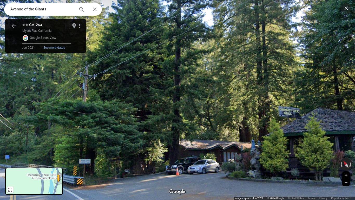
Virtual Journey: Lost Coast, CA, USA on Highway 211 - From Victorian Ferndale to The Beach, the Mountains of Mateel to the Avenue of the Giants. Humboldt County. 

https://gvan42.blogspot.com/2022/03/a-virtual-drive-thru-remote-humboldt.html


Virtual Journey to San Francisco - Boat Ride on the Red and White Fleet. Under the Golden Gate Bridge and Around Alcatraz Island... and MORE!


Virtual Journey: The Smithsonian and Washington DC. Instead of Buying Gasoline and Driving There, Take this Magic Trip Instead! A Guided Tour to the Places My Family Wanted to See... 

~~~~~~ (~);-} ~~~~~~

Handy Hints!
When designing a BLOG or Webpage: Make sure to keep Photo file sizes small so your page loads quickly... even on old slow computers in foreign countries! USE JPG format and save at 70% MEDIUM QUALITY - With a Width of image Less than 1400 Pixels. Why would anyone want their Blog to Load Slowly for No Reason?

Remember to TITLE the pictures with a meaningful name in English... put that name in the ALT and TITLE tags in the HTML: Here's a Typical name of mine... "Lord Ellis Summit in the Snow Highway 299 Humboldt County CA USA.jpg" That way Google image search can understand what the picture is about and rate it highly... and people that can't see images will know what it's all about! and People living in India or France or Australia will know that the picture is located in California, USA...

I'm often surprised that people I Know, Who Should know better, put a Large PNG format picture on their website when... The Viewer's Computer CAN'T Show the Difference! All that extra data is wasted... and the Time it takes to load a page is slowed down... Large Beautiful PNG Images are Excellent if you want to print a photo on a T-Shirt or a Coffee Cup... Like my Zazzle/gregvan Webstore... The Extra Quality is Essential to make a Great Product... BUT... not on a Blog or Website... If you are submitting photographs to make a BOOK... YES! Big Beautiful Images are Required...

Remember: The Default setting on an iPhone is a Huge File... When I use the pictures I take with my iPhone the first thing I do is use Pixlr.com to throw away 80% of the Data...

Lord Ellis Summit in the Snow Highway 299 Humboldt County CA USA

Painting for the wall of a TV Commercial's Set
Have you ever Noticed the Paintings on the Wall in TV Commercials? They All Look a Lot Like This one Above... Just a Meaningless Blob of Color on the Wall with Nothing to Distract the Viewer from Whatever the Spokesmodel is Selling... In the SET there Should be Something on the Wall but Nothing that attracts attention!


Not a Patient... Drug Commercials
I'm also disturbed by the Beautiful Hollywood Actresses cast as Patients in Drug Commercials... They Always have a Disclaimer Printed in the Screen that Says "Not a Real Patient" as if They Couldn't FIND a Real Patient to Film... they could show how the Drug performs it's Miracles... but NO... They have a Casting Call Looking for Gorgeous Babes that Look Real Healthy... PLAY BALL!

Popular Posts!


Popular Posts