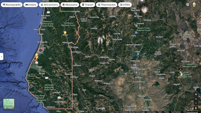
We Travel From Alton on Highway 101 a few Miles South of Eureka thru The Van Duzen River Valley All the Way to Red Bluff in the Central Valley.
It may or may not Happen... Sometime in August!
Check before driving up there... https://www.bridgevillecommunitycenter.org/bridgefest.html
~~~~~~ (~);-} ~~~~~~
Virtual Journey Starts Here!
From Eureka, Head South on Highway 101
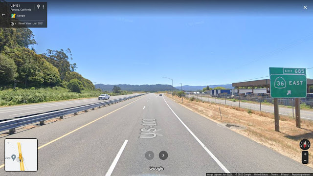 |
| Exit to Highway 36 from 101 Humboldt County, CA But before You Go... Continue South on 101 another Mile and Visit the Rock Shop. |
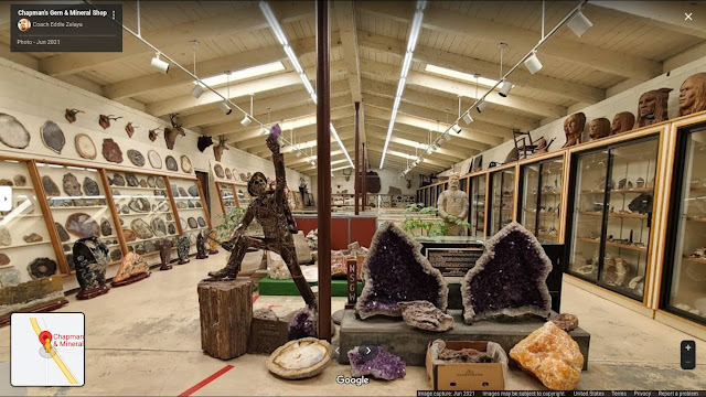 |
| Inside Chapman's Rock Shop |
 |
| We leave Highway 101 and head up into the Mountains |
 |
| Warning sign on the way to Bridgeville, CA Winding Road NOT Advisable... To ME a Promise of Wonderful Things to Come. |
 |
| Only 24 Miles to Go before We Get to Bridgeville |
 |
| Reynolds RV Repair and Storage |
 |
| Satellite View of Rohnerville Air Attack Base. At the Intersection of Highway 101 and Highway 36 ~~~~~~ (~);-} ~~~~~~ |
As the Shortest Road from Chico to Eureka I have driven this road many times. Including the first time, driving at Night when I was Doing Exploration of Eureka and Arcata in Preparation for Our Move... In 2001 when I Started Humboldt State University. The Stars are Super Bright and It's Dark and Clear Way out in the Woods... I also Drove the U Haul Truck with Everything we owned towing my little White Truck...
Every time I wanted to go Visit Friends that live in Chico I chose #36 if Possible. It's also an option to Go on #299 to Redding or #20 at Clear Lake... Depending on the Snow... The Roads are Closed in the Winter. #299 goes from Arcata to Redding thru the Trinity Alps. #20 goes along the North Shore of Clear Lake. It's a Long Drive but OPEN During Snow Days.
~~~~~~ (~);-} ~~~~~~
 |
| The White Church in Hydesville the First Town on Our Journey The Next Town is Carlotta. It was the Home of a Pacific Lumber Mill that Closed a Couple of Decades Ago. The Building Has been Entirely Removed... This is Where The Pacific Lumber Mill was. The Guardhouse is Still there to the Left of the Trees... There are No Photographs on Google Image Search of That Mill... It's as If IT NEVER HAPPENED. There were Earth First! Protests and there are Photos of Those Events but The Mill Itself Has Faded Away into the Dustbin of History. https://en.wikipedia.org/wiki/Pacific_Lumber_Company  Here's a Historical Photo:  Timber Tee Pee Burner. Years ago, the Sawdust and Wood Chips were Waste and they Were Burned in These Giant Structures. |
We stopped at a Grocery Store near Carlotta and they Had these Excellent Bears!
 |
| The Road After We Leave Carlotta Looks Like This A LOT. On the Left is The Van Duzen River. |
 |
| Another Glimpse of the Van Duzen River |
 |
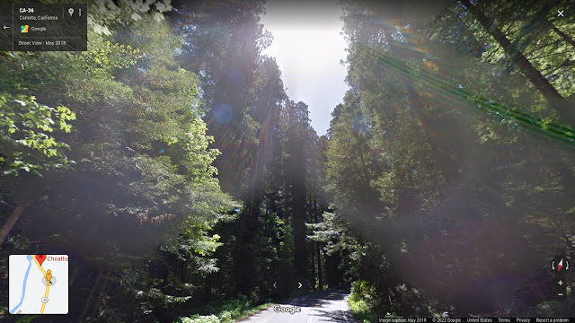
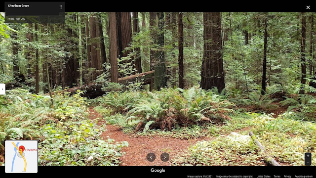
| Beach at the Van Duzen County Park - Pamplin Grove Link to a MAP: https://goo.gl/maps/4ovvKfTCHmoSXasz6 Map of Swimmers Delight Campground: https://goo.gl/maps/k4XebTsHkrbeBGfv5  People at the Beach - Swimmers Delight - Van Duzen River This is the Star Wars Forest Moon of Endor to the Cheatham Grove Campground... Link to the Google Map... Be Sure to Try the Streetview Feature! The most memorable parts of the speeder bike chase in the Star Wars movie Return of the Jedi were filmed in this grove in 1982. The grove wasn't added to the state park (and presumably wasn’t named Cheatham Grove) until 1983. Only the forward-looking steadicam shots were taken here; see the link below for more information. Sideways shots showing the riders in profile were taken from the back of a truck driving down the Avenue of the Giants, and scenes in which actors walk around in the redwoods were shot on much less impressive privately-owned land just north of Crescent City. (and that land has been logged) |
and The Road is Squiggly TOO!
Link to The Map of the Grizzly Creek redwoods State Park... https://goo.gl/maps/69HhTCRUrsjpF6GM6
 |
| Fallen Redwood Tree in the Grizzly Creek Redwoods State Park |
 |
| Stuffed Cat at the Ranger Station |
 |
| Footbridge over Grizzly Creek to the wild side of the Forest. |
I was shown a Hidden Footbridge over the EEL River on the Avenue of the Giants. On Days That I was Feeling Paranoid, I would walk to the Other Side of the EEL and Feel Safe... Almost NO PEOPLE are on the Other Side of the EEL and I'm Comfortable around animals... People are Strange...
 |
| The Old Bridge over the Van Duzen River on Highway 36. Photo taken From the New Bridge. |
 | |
| A Few Miles Further on down the Road,,, Swains Flat Outpost. a Convenience Store on Highway 36 and Finally: Bridgeville... Home of The Bridgeville UFO Festival. People Set up Tents for Vending and Food on the OLD Bridge... You can see them in the Background... and there is a Contest to see who's Home Made UFO can Fly the Farthest when Thrown off the Bridge. Bridgefest
|
People Dressed up as Aliens at Bridgefest
A Tight Turn on Highway 36
going up into the Mountains.
A Christian Summer Camp for Kids!
 |
| Side Road to a Remote Farm |
 |
| Traveling on down the Side Road... But Then Google Maps Stops... Better Not Go There! Hippies! Marijuana Farms! Shotguns! |
 |
and the Van Duzen river
Many Miles of Forest and
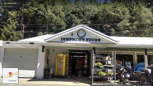
then The Town of Dinsmore...
and there were a few Hippies With
Backpacks in the Parking Lot Hoping to
Find Work as Trimmers During
the Marijuana Harvest Season...
The Riverbend Park! Not a State Park, Not a County Park but a Trailer Park...
 |
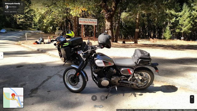
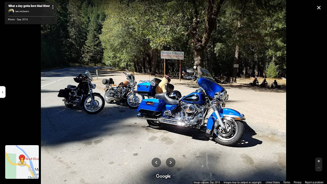
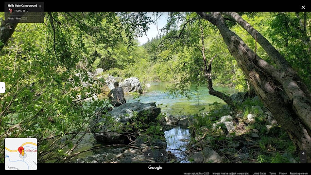
| Mad River Ranger Station https://www.fs.usda.gov/recarea/srnf/recarea/?recid=11520 Overlooking The Mad River Valley Motorcycles in Mad River at the Burger Bar... If you Look to the Left You'll see Hippies waiting for a Job Offer as a Trimmer or a Ride or the Second Coming of Christ... Who Knows? They Have to Be Somewhere and This is a Fine Place to Have a Seat. Mad River Burger Bar More Bikes in Mad River... and If You Look to the Right, Hippies with their Backpacks... |
 |
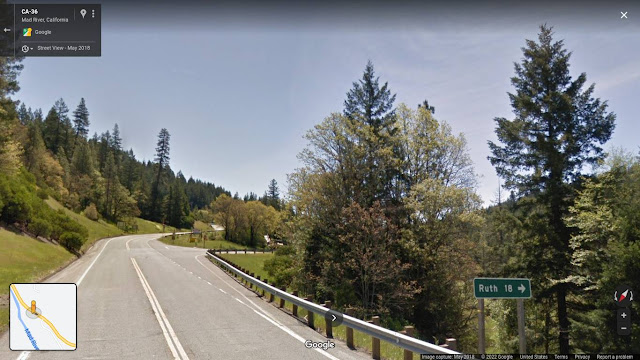
| Snowy Dirt Road near the Town of Mad River Just Beyond The Town of Mad River is the Turn off for Ruth Lake... It's 18 miles up a Twisty Road... I never went there because I turned Around at the Mad River Campground... |
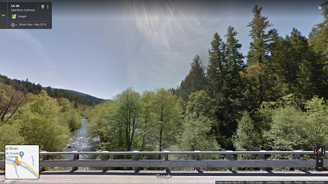
The Actual Mad River looking Downstream...
This Flows all the Way to Arcata and Enters the Pacific Ocean There.
Silly Graffiti on a Bridge over
the Mad River in Arcata, CA
The Joke is that He Got His Wish... I Was There!
Here's Photographic Evidence that Proves IT!
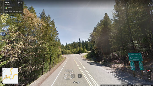
The Fork in the Road -
Highway 3 or Highway 36 -
Go to Redding or Red Bluff
Highway 3 Has a Downgrade Warning Sign Stating 10%... The Largest Number I Have Ever Seen...
~~~~~~ (~);-} ~~~~~~
Somewhere out there on Highway 36 the road becomes one lane... and that's difficult to drive at night because there is No Yellow Stripe down the middle of the road to AIM the Truck At...
Maybe it has been made two lanes the entire way recently but... I started driving it in 2001... and I remember the Stars at night were Spectacular... it's so dark out there in the woods...
Someday I'll Explore Highway 3 That Goes all the Way to Meet Highway 5 near the Oregon Border...
That's Another Even More Remote Area of Northern California, USA
I've been Saying "Someday" for Two Decades...
I'm Beginning to Have Doubts!
If I Has Chosen Highway 3...
I Could Have Patronized the
Growing Wild Garden Supply Store!
Just in Case You had a Marijuana Farm up there.
Here's a Farm on 36 as Seen from
the Bridge over Hayfork Creek.
Beautiful Christian Orthodox monastery dedicated to St. Xenia's. It was amazing to hear the story about St. Xenia from Olga. This monastery is under Serbian orthodox church which was a big surprise to me. - Said F.P.
In Wildwood, CA
Harrison Gulch Cemetery
St Herman of Alaska Monastery in Platina.
Harrison Gulch Ranger & Fire Station
Shasta Trinity National Forest
St Herman of Alaska Monastery in Platina.
Shasta County, CA, USA.
and We Come out of the Redwood Forest
and Enter the Oak Flatlands of the California
Central Valley...
Near Platina!
Beware those that Travel West...
Quite a Different Climate Than Up There
in the Redwood Forest...
Between the Mountains and Red Bluff was Endless... Here's a Biker Enjoying That Classic Motorcycle Ride... Many People Come from The Bay Area and Go Up Highway 101 then take a Right Hand Turn on 36 and Return Home on 5... It's a Weekend Loop with a Night Staying at a Campground or Motel Up in the Mountains.
One night I was Camping in my
Ford Windstar Van and...
All Night Long, at Random intervals,
Acorns would land on the roof of the Van
and Scare Me! With a Big Noise that
Sounded Like a Gunshot.
I often pulled off onto dirt Roads like this
to avoid being Hassled by Police...
I never Kept any Illegal Marijuana in the Van
because when I was Driving around and
Sleeping in the Van... I met a Lot of Police!
The Locals Reported STRANGER DANGER!
 |
| Holiday Inn in Red Bluff CA USA and This is where I Stay if I've Just Driven From Eureka... That's Enough Driving! Now, a Shower and then Off to that Mexican Restaurant! |
 |
| Casa Ramos Restaurant in Red Bluff, CA, USA |
https://purple64ets.wordpress.com/2022/05/09/operation-mindsprout-gvan42/ Free Artwork that You May Copy and Paste Into Your Own Blog, Social Media Page or Use to Create Custom Designed Gifts… (like Zazzle, CafePress etc)

.jpg)














%20(1).jpg)
.jpg)


%20(1).jpg)


